Saturday, January 21, 2017

Mount Moosilauke (4,802') (2nd climb)


I was looking to do a shorter hike because I needed to be back south for dinner. I had done Moosilauke in snow before, so I settled on it as a good pick. I also wanted to scout out the Carriage path trail for possible skiing later this winter.

The plan was to climb up via the gorge brook trail to the summit, and then come down via Carriage road and Snapper. There was a nice packed snow cover which was on the softer side. Spikes were mostly unnecessary, but I wore them for added traction on the harder-packed/steeper sections. I carried snowshoes but never took them off the pack.


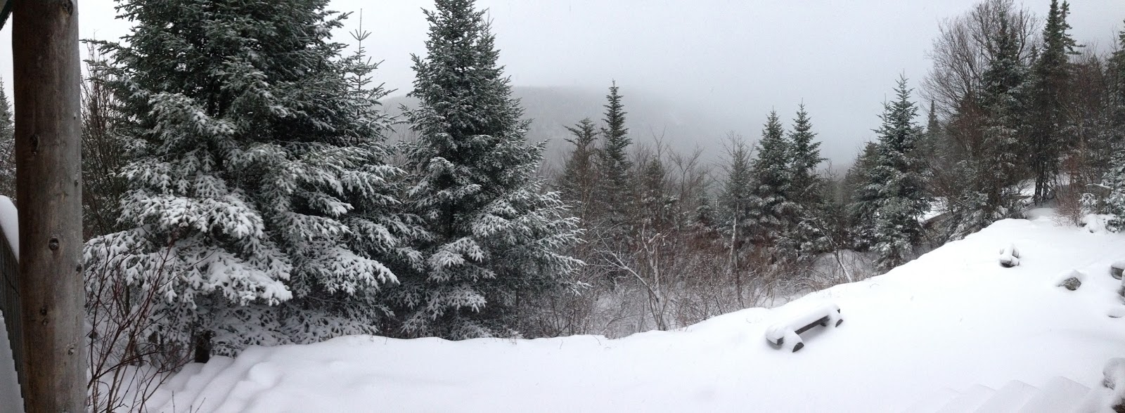
At the trailhead, it was quite foggy, but I could see the sun through the fog, so I hoped I’d climb out of it (and did). Once above the first foggy layer, I hiked in relatively clear conditions until almost all the way to the summit. Unfortunately, the summit was fogged in as well. It was dense enough that I could not see from trail mark to trail mark, and being above the tree-line, I simply had to follow foot-prints in the snow and keep going uphill.


The summit was quite windy. I’d estimate gusts in the 35-50 mph range. Given the poor visibility, and no more foot prints to follow, I decided it was too dangerous to try to find the carriage path solo. I followed my own footprints back to the treeline and made my way back down. 


(video of summit conditions)

Note: I checked out the new Deli in Truants (Merland's). Great sandwich and excellent beer selection. 


Tuesday, December 27, 2016

Lonesome Lake Hike


It's a tradition now. For the third year for Jimmy and I, and the second year for Jacqueline and Christine, we headed north to go hiking on Christmas vacation. We started mid-morning from the Basin right off of 93 and followed the bike path to the Lafayette camprgound. From there we headed up to the Lonesome Lake hut. The trail was very well packed down. We used spikes for traction, snowshoes were not necessary. We hung out at the Lonesome lake hut for a bit, and then made our way down the Cascade brook trail. Early on, snowshoes would have been better. The trail was badly post-holed, and deep in spots for the first bit.

There were a couple of iffy water crossings. We crossed on ice bridges, but didn't feel great about it. Everyone stayed dry.

Stayed at the Woodstock Inn and headed south in the morning.

Pictures here: https://goo.gl/photos/jZeVDDa67QhbWm6WA

Saturday, November 12, 2016

Owl's Head (4,025')


 I headed up after work on Friday and grabbed one of the last remaining sites at Hancock campground (in Mid-November… seriously). It snowed while I set up my tent, but I managed to keep it dry. Grabbed dinner in Woodstock and met Steve arriving from Portland back at the campground.

We hit the trail around 7:30 on Saturday morning. It starts very wide and open (a mountain bike trail) for the first several miles. We decided to attempt a bushwhack off the dead-end of the Black Pond trail on the way to Owl’s Head and to just follow the main trail on the way back. The benefit of the bushwhack is that it cuts off about a mile of distance and skips two more substantial river crossings. 

The bushwhack on the way to Owl’s Head is easy because you just have to find a trail that you’re traveling perpendicular to. On the way back it would have been quite difficult to do the Bushwhack on the return trip because we’d need to be very precise and catch the end of the Black Pond trail running parallel. Neither of us hike with a GPS.


We handled the bushwhack pretty well (traveling at approx. 350 magnetic) and reconnected with the Lincoln Brook trail pretty far west (cutting off a good chunk of distance). There were a few minor water crossings left which were made much more difficult by the nearly invisible thin layer of ice covering many of rocks in the stream. We were glad to have skipped the more substantial crossings, at least until the ice melted later in the day).

From the Lincoln Brook trail, the Owl’s Head path is actually unmarked and not officially a trail. It’s basically an unmaintained rockslide and herd path to the top. We spent a lot of time on the Lincoln Brook trail staring off into the woods to the east to make sure we hadn’t missed the path to the top. Missing it would have been pretty easy to do and cost us a ton of time and distance. When we found it, it was marked with a small rock cairn which helped.  I’m told that rangers sometimes take the cairn down. It strikes me that the safety concerns from having hikers stumbling around searching for an unmarked trail is probably substantially more dangerous than marking the entrance knowing that people will be climbing the unmarked trail. Oh well.


The climb to the top is quite steep (not dangerous, but challenging) and required microspikes at points. We made the summit by around noon which was good time. A couple of good views on the way up the rockslide, but the summit is wooded and not much to see. 


On the way back we opted to stay on the trail and add the extra distance to skip the bushwhack in the fading light. We just wanted to be sure we hit the water crossings before dark (which ended up being fine). The layer of ice that was present in the morning had mostly melted during the day, which made rock hopping much easier.

Sunset was at about 4:30, but being in the valley, it became quite dark shortly after 4. We finished with headlamps on and got back to the car right around 5:00. Book time was 10.5 hours and we did it in about 10. Distance was right around 20 miles.

I’ve read that Owl’s Head is an example of why not to do the 4,000 footer list because it’s so far and the view so unimpressive. I’ll disagree. I enjoy the challenge of getting to places that are difficult to get to. The views we did get, were well earned. At the very least it was a great walk in the woods, which is never bad.


We grabbed dinner at Black Mountain Burgers and made a big fire. We both headed back home Sunday morning. I could barely walk on Sunday afternoon, but I’ll still say “worth it”

Not much for pictures because we were hustling: Pictures here. 

Saturday, June 11, 2016

Jungfrau Region


Recapping this a few months after the fact, but based on emails and pictures I can piece it together. I'll reference the trail map included below. Because I backtracked, I lettered the path to make it more clear (A-H).

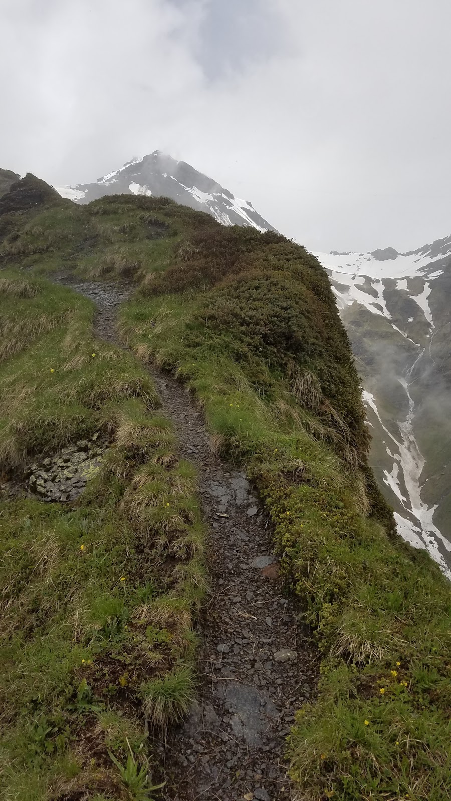
Left Murren on a rainy morning (Trail mark A). The north face trail climbs a narrow paved road at first, and then exits onto a farm path with lots of very large, not very shy cows. At several points, I had to navigate around groups of cows blocking gates and pathways. Not being a farm guy, they're pretty intimidating up close, but I got the sense they're harmless. From there I continued on the #3 trail (pink) climbing steeply up the side of the Schilthorn with lots of switchbacks. The rain stopped and in the brief periods that the clouds broke, the scenery was incredible. There was still a decent amount of snow (considering it was June).

I continued on the ridge below Bryndli (Trail mark B) and worked my way up to the Rotstockhutte. Before I left on this hike, in town, I had a hard time getting a sense for the trails and what was "safe" to do. When I arrived in Murren, I was carrying some of the luggage from my business trip, so I probably didn't look like much of a hiker. The recommendations I got were mostly paved paths and chair lifts. I was not trying to get into any ice climbing, but I don't mind some snow, and certainly can comfortably climb some grades. The B&B host discouraged me from going upward in altitude at all, and told me that the trail up Schilthorn was "closed". There's nothing marking closed trails, so I took a method of cautiously going where I wanted and backtracking if it got ugly.


Back at the Rotstockhutte (Trail mark C), the clouds cleared and I got some incredible views of the valley down to Lauterbrunnen and across the valley at the Eiger. I could also see Schilthorn from there. I never really intended to go all the way up because I knew the trails were closed, but this was my first view at how impassible it really was. The steep ridge was covered in ice, and precariously balanced 15 foot tall walls of snow overhung various points of the trail. The sound of avalanches in the valley below, made it an easy call to stop going any further up-hill. I got some soup and crackers from the hut and continued on my way.


From the Rotstockhutte I decided I'd try to take the #11 trail back to Schiltalp and reconnect with the Northface trail to get back down to Murren. I climbed the south side of the Wasenegg ridge (Trail Mark D) which is a mostly gradual climb, but increases in grade as you approach the ridge. At the top, I could see down into the valley below. It was quite clear that descending the North side of the Wasenegg was not happening (Trail Mark E). A snow bowl had formed and collected at least 8 or 9 feet high. It was a perfect crevasse recipe. My legs were still feeling good, so I decided to take one more crack at descending the north side of the Wasenegg ridge from a different (and hopefully safer route). I had heard from my brother Jimmy, that walking along the Wasenegg was disorienting. It's about as wide as a sidewalk, so quite safe to walk along, but on either side of the sidewalk is a fall that would last about 1,000 feet and not end well. If you're walking along a sidewalk, there's little risk of suddenly stepping off, but the stakes are certainly elevated walking this sort-of tightrope.


("the sidewalk")


I headed west, climbing uphill toward the Schilthorn. To the south, the rocky ridge descended back down to the valley near the Rotstockhutte. To the North, the snow bowl continued to be a daunting obstacle. I made it to the high western edge of the Wasenegg ridge (Trail Mark F) where the last trail branched north into the snowbowl, but again found it impassable. I backtracked east along the ridge toward Bryndli, once again, trying not to look down.

(not climbing down that)


When I got back to the eastern part of the Wasenegg where I started, rather than backtracking, I decided to make my way all the way down the east side of the ridge called "Bryndli" (Trail Mark G). This part was scary. The trail narrowed, and the ridge got steeper. Because of some major erosion, the "sidewalk" narrowed substantially, and was no longer flat, but rather pitched at a 45 degree angle down hill. There was a traverse rope to navigate this portion, but that's a lot of faith to put in a stranger's rope. I very carefully side stepped across the Bryndli section and stayed very low to the ground to avoid losing my balance in a gust or muddy slip.

(I don't have a picture of the worst part for obvious reasons)


After Bryndli, it was mostly back tracking to Murren (Trail Mark H). I cleaned up and headed over to the Eiger Guesthouse to watch the Euro cup. Pretty great day.

While the clouds and rain were not ideal, they made me appreciate the unbelievable views when the weather cleared. This area was the most beautiful place I've ever seen.


Hike and other Murren Pictures here


Saturday, February 6, 2016

Mount Moriah (4,049')


Headed north around 6:30 arriving at the Carter-Moriah trailhead in Gorham at about 9:45. The out-and-back trip up to the Moriah Summit is 9 miles with 3,550 feet of elevation gain with a book time of 6 hours, 15 minutes.

There was very little snow, but the trail was frozen from the parking lot. Footing was tough right away, and I had to take hard steps with the microspikes to gain good traction. For the most part the bottom third of the trail was very fast moving and not too steep. I was trying out my new winter boots for the first time (Solomon X Ultra Winter) and opened up some solid blisters almost immediately (which was expected). 

The middle third of the trail was not as fun. There were lots of short steep sections which would have been fine if they were dry or well covered in snow; however, the thick layer of hardened ice made them very challenging to navigate with just microspikes. Full crampons would have been much better. On a few of the steeper sections, I actually backtracked to make sure I could safely get down them too. I didn't want to get all the way to the top and figure out that it was too slippery to get down.

The summit had awesome views in all directions and the wind was light so I was able to enjoy it for a bit.


The way down was pretty quick but challenging. The steeper sections required sledding on my butt and using the spikes to keep from going to fast. Pretty sore all over by the time I got down. Here's an example of one of the trickier rock slides:


I made it down in just under 6 hours which was pretty good considering the amount of time I spent staring at the steep parts figuring out the best way up or down. There were a few other groups on the trail and everyone had some form of traction. The few with crampons seemed to be cruising. I saw one guy with Yak-Tracks (just chains, no spikes) I have no idea how he made it down. Must have sledded the whole way.

I also tried out my Spot PLB tracking for the first time. It spits out a cool report that shows your time splits every 10 minutes:


SLR and iPhone pictures here

Monday, December 28, 2015

Gordon Pond Hike


A few days after Christmas, Jimmy, Christine, Jacqueline and I headed up to do some hiking. We had hoped to snowshoe, but the weather didn't cooperate and instead we had a very icy, very cold day (temperature in the low teens). We picked a trail near Woodstock off of 112 and hoped to get to Gordon pond, which is about 3 miles each way.

The trail was pretty much all iced over, so we all used microspikes the whole way. Camelbacks froze quickly despite our efforts to keep water out of the tubes.

(sweet inside-out hat)


Jacqueline broke through some ice and went knee deep in water almost right away. She was a trooper and kept going despite the wet foot. Video of her frozen pant leg here:


The gang was pretty cold, so we turned back before the pond and headed back for the car. It was a pretty day in the woods.


We caught a late afternoon showing of Star Wars and then headed back to the Woodstock Inn for beer and too much food. Good times had by all.

Pictures here: Jimmy's SLR and some iPhone

Friday, December 4, 2015

Zealand Falls Hut


This one started as a pretty ambitious plan. Starting Thursday, I was going to drop my bike at the Zealand Road Trailhead (around mile marker 13 on the map below). I was then going to drive back to the Haystack Road Trailhead (mile marker 0), and hike from the car  to the Zealand Falls Hut (mile marker 11.5). On Friday, I would wake up and head to my bike and then ride the roads back to the car. This would bag me both North and South Twin Mountain, as well as Mount Zealand.


A couple things didn't work out. First, the weather. It was supposed to snow 1-3" on the ridgeline, but just be a dusting at lower altitudes. Second, it had been raining for several days before I got there leading to very high river and stream flooding. More on that later.

I left Boston at 4:30 AM on Thursday to make the most out of the late season daylight. When I got to Bethlehem, a little after 7:00 it was 38 degrees and misting rain. Pretty gross for hiking. I ditched my bike at the Zealand Road Trailhead under a tree and drove about 25 minutes back to the Haystack Road Trailhead. As I geared up, the temperature had dropped to the low 30s and I saw a few snowflakes among the rain.

Under the tree cover, the rain and snow were mostly blocked and I made very good time heading up toward the peak of North Twin. There were several higher than normal stream crossings, but nothing too troubling, and I stayed dry.

About 2 miles in, I got to a river crossing that was completely washed out. There was no where to go across without getting waist deep in fast running water. I bushwhacked off trail following the river for about half a mile, but it was all the same. There were a few places where I could get pretty close to making in across, but each one had at least one place where I was going to be very wet in fast running water. The mixed rain had turned to all snow, and I decided it wasn't worth chancing and made my way back to the car.


By the time I got back to the car, the snow was covering the road. As mentioned earlier, it wasn't supposed to snow this much down low. I decided that I wanted a plan that had multiple options to shorten or bail entirely given the conditions. Zealand was appealing because I could approach from the side of the trail with the hut, drop my pack at the hut, and continue on only if the conditions were good.

When I got back to Zealand Road, (between 16-17 on the map above) the road was already at least an inch deep in snow. I had spoken to the AMC the day before the trip and knew that they might close the road if it snowed. I did not want to chance driving 4 miles up to the trailhead only to have them close the gate and trap my car inside, so I parked on 302 and decided to walk the road. That meant my bike was stuck at the trailhead, but that was a problem for another day.

The road walk was about 90 minutes, but really cool with the trees already bowing over with snow. On approach to the hut, the wind had really picked up and was blowing the snow around. I could no longer see the peak of Zealand, and my boots had completely soaked through. It was only 2PM, but I was decided to call it a day when I reached the hut.


Like the other AMC huts, Zealand Falls Hut is unheated in the winter, but provides a gas stove in the kitchen, and dry bunks. I was the only one at the hut when I arrived, so I warmed up in my sleeping bag, read my book, and napped through the afternoon. Around 4:00, the caretaker arrived and fired up the woodstove. I spent the evening with about 9 other hikers who were passing through. We traded beers for bourbon and swapped hiking plans and ideas. A couple of guys were going to hike out really early, so I agreed to join them for the first half mile or so.


There is zero cell service in this part of the White Mountains, and I felt guilty about not being able to check-in. Getting out early sounded like a good idea. We were on the trail around 5 AM on Saturday. It had snowed over 6 inches at the hut and was still coming down a little when we set out. We trekked down with spikes on and headlamps lighting the way. I said goodbye at the trail split and made my way down to my bike alone. I was back to the trailhead well before the sun had come up, and now had to deal with my bike.


It was completely frozen when I pulled it from under the tree to the point that the wheels wouldn't even rotate. I got it on the road with the plan to just walk it back to the car. After a few minutes, the wheels were turning, so I did some gentle gliding. It definitely was not built for the snow, and I'm pretty sure most bikes aren't. I rode the bike like one of those toddler bikes with no pedals, and had my feet dragging on the ground the whole time. It took a long time (1 hr for <4 miles) but I made it back to the car without incident.


I ended up bagging 0 of the 3 intended peaks, but given the weather and being solo, I had no regrets. It was a really fun couple of days and I hope to get back to that section soon in better weather.

Pictures: here