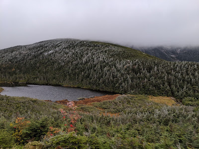
Saturday, December 7, 2019

Mount Moosilauke (4,049) Climb 3 (~100 yds from summit)


Solo hike up Mount Moosilauke via the Beaver Brook Trail from the Kanc. Much more fresh snow than was forecast. Not quite trail breaking, but definitely working for it with the snowshoes. Single digit temps at the base.


This trail is much rougher and steeper than the more traditional way up Gorge Brook. I put snow shoes on early and never took them off.

I had an ice axe and used it (because I had it), but it certainly wasn't entirely necessary.

Approaching the summit, a Forest Serviceman told me that the summit was in total white-out and to keep an eye out for some college-aged kids to make sure they had made it down. I asked if there was any reason to think they wouldn't, and he just said "they're wearing fucking sweat pants"

I bumped into the kids approaching the treeline. They were wearing sweat pants, but were smart enough to have turned around before the summit.


I decided to take a look at it, but having been up twice, I wasn't going to push it. Quickly after leaving the comfort of the treeline, the wind picked up. Wind chill was ~ -20F to -30F (based on weather reports). At first I could see Cairn to Cairn but I got to one just shy of the summit and could not see the next one. In fact, when I turned around to back track, I could barely make out the one I had come from. Very disorienting. Gave me a lot of perspective on how easy it would be to get lost.


I made my way back to the trees and got down right around book time (5:20)


Friday, October 4, 2019

Pemi Loop: Flume (climb 2), Liberty (Climb 3), Lincoln (Climb 3), Lafayette (climb 3), Garfield (Climb 2), S. Twin (Climb 2), Bond (Climb 2), Bondcliff (Climb 2)


Steve and I planned this as a 3-day loop which worked out to about 10.5 miles each day. The traditional route would've taken us all the way from Lincoln Woods to the Garfield shelter, but with it being a cooler weather hike, staying indoors one night sounded appealing. We decided on:

Day 1: Lincoln Woods to Greenleaf Hut (10.6 miles, 5,600 ft of gain)
Day 2: Greenleaf to Guyot (10 miles, 4,530 ft of gain)
Day 3: Guyot back to Lincoln Woods (10.4 miles, 1,100 ft of gain).

The downside to this plan was that it meant we had to hike down about a mile and ~1,000 ft from Lafayette to get to Greenleaf hut on Friday, only to have to climb back up it on Saturday morning. Seemed well worth it for the benefit of getting to dry off and have a "warm" night indoors.

Friday was in and out of the clouds (mostly in), but had some pretty insane views when the clouds briefly lifted. Up on the Franconia ridge, it was very gusty (north of 50 mph) and definitely enough to push us around a bit in the puffs.

The weather deteriorated through the day and by the time we got down to the hut, it was a major relief to be getting inside. Temperatures plummeted overnight into the mid-teens and the wind shook the building all night.

We were hiking with a group that was headed to Garfield shelter, but with the conditions, they didn't make great time and ducked down to the Greenleaf hut in hopes of finding somewhere to stay for the night. They were turned away and spend the night in the woods. I can't even imagine how cold that must have been. The hut was still in "full-service" season, so we got a hot dinner and some blankets in the bunks. With a 17 degree rated sleeping bag, and 3 heavy wool blankets, I was warm enough, but it was close, and many other complained of being cold inside.


On Saturday we woke up to a solid frost cover and some black ice on the west side of Lafayette. We made good time to the top.

There we were greeted with our first clear view of the Pemigewasset valley. In the picture below, I'm looking toward the West side of the Bonds where we would finish our hike for the day on Saturday.


We made our way along the Garfield Ridge trail which was mostly clear but had some patches of black ice along to the Garfield summit.
(looking south From Garfield toward Owl's Head)


Saturday, September 28, 2019

Osceola (climb 3)


Got a late start and headed to Osceola via Tripoli road. Only had time for 1 peak with the early sunset and rain coming in the late PM. Nice gradual climb. Light rain for part of the return trip.


Stopped at Pemi Public house on the way back home (Woodstock Inn was packed) and got some food. 


Saturday, August 3, 2019

#48! Presidential Traverse: Madison (5,367’) (climb 2), Adams (5,774’) (climb 2), Jefferson (5,712) (climb 2), Washington (6,288’)(climb 2), Monroe (5,384’), Eisenhower (4,780’)(climb 2), Pierce (4,310’)(climb 3)


This came about while brainstorming about good ways to finish the 48. I had only Cabot and Monroe left, and definitely did not want to finish on Cabot. It also seemed somewhat anticlimactic to just do Monroe on it's own, so a presi-traverse was the logical way to conclude the list.

(Airbnb)

A group of eight of us met up on Friday night just North of N. Conway at an Airbnb. We spotted cars (3 at the south end) and crashed early. Alarms went off at 3AM and we were at the Appalachia trailhead by 4:30AM. The big challenge was trying to time it so we could make the 6PM dinner time at Lake of the Clouds Hut without having to rush the whole time. Steve and I meticulously worked out some "splits" so that we'd know how we were doing on pace (so we could opt to skip some summits if necessary). The 4:30AM start time was actually later than planned, so we started the day in a 30 minute hole.


We made excellent pace from the base, and even with the (slightly) delayed start, reached the hut over an hour ahead of our split time for the segment. We dropped packs at Madison Springs Hut and headed up Madison (quick trip) and returned to fill waters at the hut and retrieve our bags. When we reached Adams, we were over 90 minutes ahead of our plan, but with a long way to go.


The boulder fields on the ridge between Adams and Jefferson slowed our pace considerably. Even when the grade is relatively flat, it's very difficult to make quick progress while planning every step and occasionally stepping on an unsettled rock. The final approach to Jefferson is also very steep with several false summits along the way.


From Jefferson we proceeded toward Washington (which seems impossibly far away). By the time we got to the trail split (one trail headed up to the summit and another circumventing the summit and going straight to Lake of the Clouds Hut), we had lost most of our "lead" against the planned time and we were pretty much right on track to make it to the hut at dinner time.


There was some discussion over whether everyone would go to the summit, but ultimately everyone decided to go for it and we made our way to the top. By this point, we had been on the trail for 12+ hours, so it was strange to see people coming down from the Washington summit wearing jeans and sandals (having driven or taken the Cog to the top). The summit was packed with people, so we didn't stay long. We grabbed some snacks and pictures, and headed out again toward Lake of the Clouds.


Once over the Washington Summit, I could see Monroe (my 48th and final NH 4,000 footer) just above the hut. It looked very close to the Hut. We arrived at the Hut around 5:30 and found our way to our bunk rooms (for future reference, the AMC Huts will put groups with separate bookings in the same bunk room if you tell them in advance that you're a single group). We didn't know this, and ended up scattered throughout the hut (NBD). Dinner was a full Turkey dinner with potatoes, gravy, green beans, etc. It was delicious.


After dinner, the group geared back up to join me for the last 300 vertical feet to the top of Mount Monroe. I felt guilty because I know everyone was beat, but I was really grateful that everyone understood that I couldn't sleep knowing I was 0.3 miles from the end of my 13+ year goal.


Simply put, this was the perfect way to finish. We reached Monroe's summit just before sunset. Jacqueline busted out a bottle of champagne that she had lugged 13+ miles and 7,000+ vertical feet over 5 summits. We hung out and watched the sunset and made our way back to the hut.


Nobody lasted long. After a couple swigs of bourbon, and a look at the impressive stars on a clear night, we were all in bed well before 10.


The Hut "Croo" doesn't fuck around with the wake up calls. At 6:30, they were going room to room with a guitar and singing. Breakfast was excellent, and we were back on the trail around 8:00. I was definitely sore, but felt way better than I expected to, and Day 2 was comparatively quite easy (~7 miles and 1,500 elevation gain). 


We by-passed Monroe and went up over Franklin on the way to Eisenhower. It was foggy and windy when we started, but the fog burned off just in time for us to reach the Eisenhower summit.


From there, we made excellent time on the well worn (not rocky) trail to Pierce. At that point the group split up with half going over Jackson and the other half headed straight down to the cars. We met at the bottom and everyone headed out.


A few of us went over to "The Lodge" (a property of the Mt Washington Hotel) to relax on Sunday night. Jacqueline and I headed to meet Jimmy, Christine and the girls at the lake on Monday.


Going into this trip, I was really worried about my knee (which I impaled in a yard work accident in May) and my back, and neither bothered me at all on the trip. It was a huge relief.

Not sure what's next. I haven't thought much about other lists yet, although I'm obviously aware of them. I'm definitely going to do some more backpacking over old favorites. I'm looking forward to some more winter stuff now that I have all the gear. I'll also join Steve as much as I can while he's wrapping up his list.


Saturday, July 13, 2019

Lafayette(5260'), Lincoln (5089'), Haystack (4840') (Climb 2)


 Jacqueline and I used this one as a warm-up for the presi-traverse in a few weeks.

We drove up from Norwood and parking was full at the trailhead. We used the park-service shuttle from Canon which was pretty efficient but still cut into our start time a bit. We hit the trail around 9 AM with a LOT of other people.

I barely hike in the summer season anymore and this was a good reminder why. I knew it would by busy but this trail was too crowded. For the 7+ hours we were out, there was no time when I couldn't see at least 4-5 other people. Even in the most remote and narrowest parts of the trail.

It was hot and humid at the start but cooled off a bit when we neared the Haystack summit. We grabbed some food there and blew past the Lincoln summit going straight to Lafayette for a break.


From there we headed down old bridle path stopping briefly at the Greenleaf hut on our way down. Views were beautiful and it was a nice day out despite the crowds. Jacqueline checked off #5 and #6 on the 4,000 footer list.

We stayed in Woodstock and made our way back on Sunday AM.

I ended up lucking out and getting a picture from a similar vantage point as when I hiked Lafayette in December. With windchill it was -30 degrees that day, so it was over 100 degrees warmer at the top today.